Thursday, December 20, 2018

Winter Storm arriving Dec 26?

It was December the 20th, and on this date, the NWS was beginning to take notice of a very large and intense low pressure system that was currently located off in the Pacific. No one was sure, at the time, as to the track or impact that this system might have on Midwestern states around December the 26th! At the time, all three computer models were in agreement that there was going to be some sort of weather related impact! I planned to track the progress of this low to see what it does...

Dec 20 - While it was windy in the center part of the Midwest,  low pressure system was still slowly approaching the West Coast on Thursday.

 Dec 21 - There was still a large amount of uncertainty as the the track of this large storm. On model, the GFS (Global Forecast System - One of the operational forecast models run at NCEP. The GFS is run four times daily, with forecast output out to 384 hours) sees the system running a southerly track while the ECMWF (European Center for Medium-Range Weather Forecasts - Operational references in forecast discussions typically refer to the ECMWF's medium-range numerical forecast model, which runs out to 10 days) is calling for a more northerly run. We could see rain with one and snow with the other. Stay turned.

Sunday, December 9, 2018

Mid month temps looks to be above average!

Taney County MO. - The middle of December is generally a pretty tame period of time, weather wise. And, just as the averages of the last four years show in the graphic above SW MO to be a little warmer than average, this December seems to be following a slightly cooler which is also a more normal track.

Then, looking at the projected average temps for the middle of the month (see graphic at right), show every indication that we will be following well above the 30 year historical average of 35°F. As of Dec 17 we were 7 degrees above the average, as measured at the Forsyth MO location.

And, as of the 17th, there were no indicators pointing to any severe winter weather during the remainder of that period of time.

Thursday, December 6, 2018

Early December storm could pose travel problems!

Friday Dec 7 and Saturday Dec 8 Wx maps
 Taney County MOFrom a "classic" heavy snowfall standpoint for the Missouri Ozarks, there are some large concerns when slicing and dicing the global Models. Even a small shift in the track of the center of low pressure will result in very large changes in what could occur over southern Missouri. That said, the NWS will be issuing a Winter Storm Watch  for far southern Missouri.


 Accumulations of snow from 3 to 6 inches (and more) are possible with some icing occurring in the SW corner of the state. Bottom line! Stay glued to local media weather outlets as we get closer to the weekend! www.taneyweather.com

Tuesday, December 4, 2018

Below normal temps over the weekend of Dec 7th!

Forecast highs and lows
Taney County, Mo.- Everyone should maybe to try and take advantage of Wednesday's brief warm up! With temps in the low 50's on that day, it could be a good time to get in some groceries, gas up the car and maybe stoke the old furnace. The temperatures outdoor will be taking a bit of a dive, beginning on Thursday, with a winter storm threatening to swing by late Friday into Saturday! Compared to the average of 35 degrees, these next five days will all be well below that number! In addition, winds out of the NW could affect the wind chill readings! Adding those to the chance of a snowfall that could stick on the ground for awhile and you have a recipe for some potential winter problems cropping up if you're not prepared! www.taneyweather.com

Snow chances increasing for weekend!

Fri-Sat Winter forecast: All weather eyes will likely be on the coming weekend as a rather powerful system could impact the region. At this time, it looks like colder air aloft will turn most of the precipitation into snow with accumulating snow expected with higher amounts over southern Missouri, including Taney County. Potential accumulations of up to 4 inches are possible along the MO/AR border. This forecast is likely to change right up to Friday night, so stay tuned to weather outlets, if you will be traveling. www.taneyweather.com

Monday, December 3, 2018

Snow a possibility for Dec 7-8!

Taney County, MO. - Sometime in the Friday, Dec 7 to Saturday, Dec 8 date ranges; a strong low pressure system is forecast to move through the southern and central Missouri region. Given the forecast temperatures for those days will be close to or below the freezing mark, any precipitation that falls on the north side will likely be in the form of snow.

As this forecast date was still some ways off, as of this post, computer models were in disagreement as to exactly where the north region was going to be. That said, it's a good idea to be weather aware as we approach the weekend!

Sunday, December 2, 2018

Monster winter storm targets the Midwest!

Fictional Account: In what has now been termed the Storm of the Century, a number of factors came together to result in the stranding of tens of thousands of Missouri residents!

On the evening of December the 17th, a low pressure system transited across the gulf states throwing up moisture laden air into the center of the United States. This air slammed into a arctic vortex that barreled down from northern Canada. Boasting temperatures in the low teens, the super chilled air travel quickly over a fresh snow pack that cover the northern tier of states. These two forces coming together, resulted in hurricane force winds that carried a mixture of sleet and snow. Before the dawn of the next day, snow amounts were in excess of 13 inches in some locales with eight foot drifts that closed many key arteries. Power outages were widespread.

In the southwest portion of the state, cities like Branson were also treated to a horrific ice storm that coated trees, bridges and power cables. Reports of downed power lines were so numerous, that a State of Emergency was announced by the Governor's Office. Thousands were without power and also could not travel due to treacherous road conditions as of Tuesday, December 18. The National Weather Service then announced the approach of an even larger system that was forecast to arrive over the weekend.
------------------------------------------

While this piece was just a flight of fancy, such a storm could happen sometime in the future. Everyone, then, should take sensible steps to insure they have some of the following:

Have a Weather radio on hand that is turned on all the time.
Have enough food to last at least a week.
Have an auxiliary source of heat or generator.
Get a check up for your vehicle or vehicles. Be winter ready!
Have a get out of Dodge plan to move out of a severe winter storms path.


Saturday, December 1, 2018

December week 1-7 temps!


The projected average temps for the first week of December show us starting out warmer than normal, but then quickly diving down into the 'average' territory of 35 degrees.  Next Friday and Saturday look to be the best of the bunch. Then beginning with Sunday Dec 7, things look to chill down a bit...

Thursday, November 29, 2018

Storms and a cold front beginning Nov 30!

So, here's the latest word concerning an approaching storm system that will bring showers and isolated severe thunderstorms into the Taney County area Friday night (Nov 30) and into Saturday (Dec 1). At this time some areas may receive strong winds and damaging hail! (Still a bit too early to tell exactly what form of severity they might take).

The system is forecast to move through the Ozarks rather quickly exiting to the north and east of much of the region by Saturday afternoon. See the national radar loop by clicking here.

A return of cold air will occur behind the system as a cold front swings through the region as the system departs. By Sunday night into Monday morning, a batch of precipitation will move across the
area. With colder temperatures it will likely fall as snow Sunday night and change to rain or a mix during the day Monday before changing back to snow as the system exits the region Monday evening. No snow accumulations are expected at this time as snow amounts will be light.

The cold air will remain in place through most of next week with highs in the 30s each day. A slight warm up will occur by Thursday with highs in the lower 40s, but another potent storm system is on the horizon for the end of next week.

Wednesday, November 28, 2018

Winter 2018-19: My weather predictions!

Forsyth MO. - It's November the 28th and the overnight temperatures had dipped to around 25°F! And that sort of abnormally cold weather had been pretty much the norm since after the first week of the month! In looking at a chart that showed the last prior four average temperatures for November 2014-2017, I could see that this year was a significant departure from the normal average of 46 degrees! As a matter of fact, there were some days that seemed closer to what we'd get on a typical January! So, what does that mean?


 In all probability, it doesn't mean all that much when taken by itself. And yet, the Central northern states had already experienced its first true blizzard of he season, and it's not even going to be 'winter' until December the 21st!  The picture taken below was in the city of Chicago, a location that was hit with over eight inches!


As a matter of fact, much of the northern tier of states have seen some significant snowfalls with temps this morning in the teens over much of that region. (Historically, when you see an early snow pack, the winter in Missouri can be more severe as any cold fronts that slide down over the snow covered ground will not gain as much heat as that air might normally gain). That's not always the case, so we need to watch to see if the trend for colder than normal temps will continue. That said, the temperature forecasts for the for the first week if that month are not very encouraging! www.taneyweather.com


Tuesday, November 27, 2018

Ten day temp averages for late November and early Dec!

Forsyth Mo. - Looking at the average temps may seem a bit strange as most of us want to see what the daily high and lows will be. I like to think in terms of the average temp for the day as an indicator of where we are in terms of 'normal' historical temps. Historical, in this case, being the 30 year average for whatever month we find ourselves in. For any given November, that temperature in southwest Missouri would be about 46 degrees. (That translates to something like a hi and low of 57°F and 35°F).  That said, the chart for the last of November and the first part of December shows a continued trend of below normal temps. Tuesday, December 4, is looking particularly cold.

Looking back at the last five Novembers! Why this one was strange!

So, November has turned out to be the oddball in the mix of the last five Novembers in Forsyth MO! I came to that conclusion after taking the averages of each average day from 2014 to 2017 and then plotting that against 2018.

Even a casual glance shows a rather large deviation (-4 below average) of the daily average temperatures for this year. Why is that even significant. Well for one thing, it could an indicator of a change in the types of winter we've all grown used to... or not. What was for sure, as of November 26, was that while temps had stayed right at about normal for a long stretch of time, that something had changed. Now, whether that change really means anything is the fly in the weather ointment? Still, it'll be interesting to see what happens in December!

Sunday, November 25, 2018

Another Sunday and another cold front?


Forsyth MO. - A dry slot will spread into much of the area today, besides the far northern portions of the forecast area. This dry slot will result in the lose of cloud and result in more of the way of drizzle developing mainly south of Highway 54. With temperatures falling through the day, a brief period of freezing drizzle will be possible and could result in a glazing of icing on elevated surfaces this afternoon into this evening mainly north of Highway 60. With temperatures currently quite warm early this morning, ground temperatures will also start off on the warm side. The onset of any wintry precipitation should generally melt, with any accumulations associated with bands of heavier snow. As temperatures fall into the 20s on gusty northwesterly winds later today, ground temperatures will fall this afternoon and evening and could result in wet roads freezing in spots and snow starting to accumulate, mainly along and north of Highway 54 where more snow is expected. The gusty winds will also reduce visibilities within any snow. A Winter Weather Advisory has been issued generally along and north of Highway 54 where more snow is expected  https://taneyservices.net/

Wednesday, November 21, 2018

Storm system on Sunday to usher in below normal temps!

 Well, it is getting to be late in the fall season with December lurking just around the corner. So bundle up buttercups...

Forecast: A rather active upper level pattern brings us yet another seasonable mild day for Saturday before another digging trough over the plains brings the next system into the Ozarks Sunday. Models have begun to find agreement on the track of the system with the low center tracking generally along and north of the I-70 corridor across northern Missouri. This will keep the bulk of the precipitation and any potential for accumulating snow on the back side of the system confined to the northern most parts of the Ozarks across central Missouri.

The primary impact with this system may become the very windy conditions expected as a tight surface gradient develops. Winds will likely gust from 30 to 40 mph at times during the day Sunday.


 Behind the system Sunday, temperatures once again drop with lows Monday morning in the 20's.

The remainder of the week, while dry, will remain on the below normal side of the temperature scale for this time of the year with highs some 10 to 15 degrees below normal in the 30's and 40's through the remainder of the week. Overnight lows will also be about 10 degrees below normal.

I noted that some weather forecasters were painting a more snowy pattern for the Sunday-Monday time frame. Should such an event occur, the snow pack would all but insure colder temps as we moved into December.
 
www.taneyweather.com

Saturday, November 17, 2018

First half of Nov 2018 five degrees below normal!

Forsyth MO. - I watched with a little bit of concern, the manner in which the temperatures sort of fell off the cliff over the first fifteen days in November! After experiencing a few past years that saw very warm temps, as high as seven degrees ABOVE the normal average, I had concluded that the Global Warming bull shit might have something going for it. But, no! the mercury began the month in fine fashion and then dropped like a brick! (I even saw a few days that were more reminiscent of late December)!

That all said, we seemed to be heading back to near normal conditions for the second half of the month!


Monday, November 5, 2018

Average temperatures drop in first half of November 2018!

After experience a very typical October, here in southwest Missouri, the temperatures had taken a definite downwards curve in the first half of November 2018! www.taneyweather.com


Thursday, November 1, 2018

November 2018. Some initial thoughts!

After a pretty typical October month had come and gone, November entered in rainy and cold fashion with temps barely hitting the 50 degree mark for a high. Thus, as we enter into mid fall, I was left wondering how the coming winter (starting on Fri, Dec 21) was going to go...

Wednesday, October 17, 2018

Mid October 2018 average temperature trend continues!

When it comes to the winter weather forecast for the 2018-2019 season, the NOAA has reported that there is a 70% chance that we will have an El Niño winter season, meaning early predictions call for a warmer than average winter across the United States. Well, that the official forecast at this point in time!

Saturday, October 13, 2018

Mid October averages to steer more towards normal!


Using nothing less than state of the art graphics, I put together a mid October sort of forecast for what I think will be the average temps across southwest Missouri. For this model, I colored in zones of hot, nice, cool, cold and frigid average temps. (I feel that the average temperature for any given day gives one the feel of that day). And, as can be seen, we are in for a more 'normal' weather period than what we experienced in 2017, at least for the mid portion of the month. As the the normal average works out to be 57 degrees (Hi 70 Lo 44), we will  likely be running just a bit below that figure, through about the 22nd of the month.

Wednesday, September 19, 2018

Why I'm all in for Global Warming!

Over the past many years, I've maintained a small weather reporting station (Davis Weather Monitor II), that despite its age, has been recording fairly accurately. Below, for instance, is a graph of the last five August's low temperature averages (note that 2015 was missing).


Many climatologists seem to agree that the best test of Global Warming would be to watch and see how well the atmosphere cools each day. Therefore, they watch the average lows to get a feel for what's going on over time. The graph above shows an average increase of 3 degrees for that '6' year span. A trend that I've seen played out again and again for every month and over many years.

So, does that indicate that things are getting warmer for Mother Earth? You betcha. As far as I'm concerned the results are in and we all will be seeing the effects of warming weather here where I live in southwest Missouri!

Here's the deal. Rather than worry about it, I actually am looking forward to a January where we will be able to have palm trees in my neighborhood! Yes, I like the increased heat! Now, does that make me some kind of nut? Perhaps, but as I have only a relatively short span of time left on earth - well that's all I really care about. You see, one second after I'm dead, I won't give a damn, will I? And anyway according to the article Sperm Zero, we're all going to be extinct by about 2046...

Friday, August 31, 2018

After a very hot summer 2018, what about the coming winter?

SW MO - The summer of 2018 was on the wane on the last day of August, and in true fashion, it was warm at 90 degrees! Thus, in only about twenty more days, we will all bid adieu to what was one of the hottest summers on record for the Midwest. Fall will arrive promptly on Saturday, September the 22nd and I'd like to think that many of us just might sigh with some relief! Hot and humid days spent indoors next to the AC will soon be replaced by much more livable, shorter and cooler days! A good time will be had by all! And, then, winter will inevitably arrive on the 21st of December.... Arrg!

So, what can we expect on the days following the shortest day of the year? Well, if you believe in the Farmer's Almanac, the signals were a bit mixed this time around. Here's a quote from Farmers' Almanac Editor and Philom Peter Geiger. "Contrary to some stories floating around on the internet, our time-tested, long-range formula is pointing towards a very long, cold, and snow-filled winter.” He then went on to state, "We stand by our forecast and formula, which accurately predicted most of the winter storms last year as well as this summer's steamy, hot conditions." Hmmm.

But what about global warming and all that? That is a good question. However, whenever you have a planet with seven and a half billion souls, many of who live by burning wood and coal and when you have an extremely complex climate with melting poles adding tons of fresh water to salty oceans....

The bottom line is that we will all just have to wait and see what will be.....

Monday, July 9, 2018

Summer heat to really set in!


SW MO. – By mid week on July 11, the southwest Missouri area will be getting a good dose of summer time heat with highs working their way into the mid nineties and then hanging out there for a while. With heat advisories likely, the only hope for any relief will be popup styled storms that will likely be few and far between.

Wednesday, June 27, 2018

On the early heat of the season for 2018!

Forsyth MO. - It was just half past 10AM on June 27, 2018 and already the outdoors temperature hung momentarily at 85 before going upwards! Adding insult to injury, the humidity was no slouch either, coming in at 62%! Area-wide, the National Weather Service had issued a heat advisory with planned readings in excess of 100 degrees by the following day. As a weather watcher of many years, I was growing a bit concerned.

My feelings were based partly on science and partly on intuition. June was coming in far above normal! (Highs were 5 degrees above normal and lows 8). When averaged, that was 6.5 degrees above the 30 year average... (And, that trend of it being warmer than normal has been going on for some time now). So, what's that mean for the coming month of July. Well, since the normal high and low for that month was 89/65 (Fahrenheit), then after applying an average 6.5 increase, you'd get 95.5 and 71.5 degrees respectively! Note that the thing about averages is that the actual temps will tend to wander around that average, with some days being higher while others could be much lower on any given day. So, while we might get a rainy day here and there that might help, we'd also get a lot of days that would see readings well above 100 degrees! [Wait! Is that what I'm forecasting for July?] No. I'm just prognosticating based on trends I've observed. It's also possible that July will turn out colder than normal, but I'm wouldn't bet the bank on that happening.

Another consideration for a really hot July would be the increased severity of any storms that might ride through an area on a frontal system or merely popup in the late afternoon. (The warmer and the moister the air packet, the faster and higher it will rise in the atmosphere). Such explosive potential is part of what can give rise to very large hail streaks, gustnadoes and the like. Oh, yes and lightening can also increase in intensity too! All in all, not a very fun scenario for those who spend time outdoors. At right, on an otherwise clear day, a couple of short-lived indicators for hail showed up at about 11AM in the morning!

The bottom line will be for everyone to be weather aware when out and about this summer. A weather radio would be a good thing to have, especially if you like to go boating.  www.taneyweather.com


Saturday, June 23, 2018

Sunday, June 24, could be interesting weather wise!

Taney County MO. - After a nice and quiet Saturday, the next day - Sunday, June 24 could prove to be anything but as the weather computers are forecasting a fast moving and energy laden storm system swooping out of Kansas into southwest Missouri early Sunday morning!

Depending on a number of factors, some unfortunate locations could see straight line winds, large hail and even tornadoes, as the frontal system sweeps through the region! www.taneyweather.com

Sunday, June 17, 2018

Doppler radar down in Springfield!

Anyone who might drive close to the Springfield Missouri airport may have spotted a tower with a white egg on top of it. That's the National Weather Service's Doppler radar which watches for storms all across southwestern Missouri. The trouble was that the radar went down on the 14th of June due to a storm that caused one of the 'gear joints' break, in the aging 25 year old tower. Repairs were expected to take as long as a week. Thankfully, this coincided with a period that saw few storms in the region.


In this National radar composite above, you can plainly see the gap in coverage circled in black. The other radar sites can be discerned as gray splotches.  Should repairs not finish before a major storm outbreak, the Springfield site will get assistance from other cities to try and help keep everyone from harm. When and until it's functioning again, everyone will need to be especially aware of any popup storms that might come their way!

This was the official notice published by the NWS on June 15:

The WSR-88D Doppler Radar (KSGF) at Springfield, Missouri has experienced a hardware failure and is not operational at this time. Parts have been ordered to repair the radar and National Weather

Service radar technicians will be on site this week to begin repairs. The radar will be restored to normal operation as soon as possible.

So, how long will the site be down? I'm betting it will be back up by Wednesday, June 20..But, then again, I'm an incurable optimist! Note: I did reach out, via email, to the NWS but never received a response back.... At any rate, the amount of time it takes this essential government agency to repair that device will be a good indicator of the health of the NWS!

www.taneyweather.com

Friday, June 15, 2018

Is Forsyth Missouri in increased wind and hail peril?

Is tornado alley moving to the east?
Forsyth MO. – In just three years, my home has been subject to three large hail events and two tornadoes! Insurance damage incurred had risen in the the thousands of dollars, leaving some folks wondering what the heck was going on?

It's really no secret that the climate is changing in front of our eyes in 2018. Global temperature averages are on the rise, and as it gets warmer, storms can develop more often with a tendency towards increased violence! That seems to be most definitely the case in my location in southwest Missouri as of late. And anyone who has ventured out in June, has certainly experienced the above average heat!

So, what's the deal? Can we expect storm system to become more numerous and severe in nature. The answer is sort of. In actuality, it isn't so much the storms themselves, as it is their locations that may be changing. And it's possible that the area of the Nation known as tornado alley may be shifting more to the east as other climate factors come into play! Dr. Greg Forbes of the Weather Channel has an interesting short video on this subject.

Traditionally, storms move more and more to the north as we enter into the summer months. It will be interesting to see if that pattern holds for the rest of 2018!

Thursday, June 14, 2018

Summer heat already?

Forsyth MO. – With the start of summer still a week away, June 2018 has proven to feel more like July. With 7 out of 14 days topping out at or above ninety degrees, one has to wonder what July and August will look like? Of course, when one brings up the topic of global warming, it's not the daily highs that need to be watched. It's the lows at night that 'could' bode ill for planet Earth. Thus far in June, the Forsyth Missouri area has averaged about six degrees above the 30 year historical average! And, as I've looked back over the prior months and years, the temps have 'most always' been at least two to three degrees warmer than that average, month after month.... year after year...

https://youtu.be/81-sSjPf57I
So, does that really mean anything to us in the short term? Yes, it does but most individuals would rather keep their heads buried in the sand on this issue. What they may not be able to handle, however, it the simple fact that when the nightly temperatures start to hang out in the mid 70's in a consistent manner and over a period of months – Well, the daily highs can then springboard up rather quickly to the nineties and beyond. And often, when you see this form of scalar temperature profile (one that always seems to be headed upward), the storms that tend to develop get even more severe than what we've all grown accustomed to! (In my home location, just this year thus far, we've already had a major hail storm and a tornado!

[Note: Looking back over just the last three years – Two F0 tornadoes and three hail storms that have totaled over seven thousand dollars in damage to me, or more specifically, my insurance company)!] Is the worst yet to come? Stay tuned!

Other than that, please enjoy your summer and let's all hope for a cool spell.... www.taneyweather.com

Saturday, February 3, 2018

Taney County Wx work week 1 - 2!

SATURDAY

The region will remain in a zone of broad lift in the mid level flow with limited moisture over riding the front across much of the area on Saturday. Model guidance continue to show light moisture as well as forecast soundings show a signal for freezing drizzle with the occasional light freezing rain shower or sleet shower. The main upper level system and support will arrive Saturday evening and night as it moves across the region. This feature will use what limited moisture is available and develop more areas of light freezing rain/drizzle and light sleet. There will be light snow across central Missouri back into eastern Kansas. All the light wintry weather will exit the area from west to east during Sunday morning. We are expecting at least a glaze of ice everywhere with up to a tenth to two tenths of ice possible for areas near I-44 and across southern Missouri. A coating of light sleet or light snow is possible everywhere with the best potential for up to a inch of snow across eastern Kansas into central Missouri.

SUNDAY

Sunday will struggle to get much above the freezing mark with the lows dipping back down into the 20's. 

MONDAY, FEB 12

Monday will be a seasonable day with sunshine and quiet weather. A broad west to southwesterly flow will set up for early and mid week with southern winds return by Tuesday. We will see our temps respond nicely back into the 50's by Tuesday and 60's by Wednesday and Thursday!

TUESDAY

The weather begins to improve on Tuesday as isentrophic upglide conditions bring in some overrunning warmer and moisture laden air! All that moisture will add to the cloud cover and a few showers, mainly over central and south Missouri would not be counted out!

WEDNESDAY and THURSDAY

Spring-like temperatures are still expected Wednesday into Thursday as southerly winds increase. High temperatures will climb into the 60's both days and cannot rule out a few locations reaching 70 degrees on Thursday.


THURSDAY LATE

A strong cold front will arrive Thursday night as a broad low amplitude trough transitions eastward across the the northern CONUS. Showers and perhaps a few thunderstorms will with the
frontal passage, especially along and south of the Interstate 44 corridor where moisture quality will be better.

FRIDAY

Strong cold air advection will follow the frontal passage on gusty northerly winds late Thursday night into Friday. This may bring a brief transition to light snow before the precipitation ends late
Thursday night into Friday morning. However little if any accumulation is expected.

Forecast certainty decreases this weekend into next week as a more active southwesterly flow evolves in response to a developing upper level trough out west. This will bring milder temperatures
back into the region along with periodic chances of precipitation into the middle of next week.


Saturday, January 27, 2018

Taney County weather going into Feb 2018!

SUNDAY – MONDAY [JANUARY 28]

On Sunday, a shortwave trough drops through the flow with an increase in 850mb-700mb moisture during the day and then moves across the area Sunday night with its associated cold front, so expect another mild day with highs well into the 50's. As the front/wave moves through Sunday night, models are beginning to indicate the potential for some light precipitation across the northern counties. At this point, thermal profiles from both the NAM and GFS would suggest light snow and or flurries. We are not expecting anything impactful (sp?), but could see a very light dusting at most. This will quickly exit early Monday morning with high pressure then building down across Kansas and Oklahoma for quiet but colder conditions both Monday and Monday night, as highs drop back into the 30's to near 40 and lows in the teens and 20's.

TUESDAY

The surface high moves off to the east Tuesday, with winds coming around to the south. The pressure gradient really tightens between the departing high and a strengthening cold front over the Plains. The combination of rising mid level heights and strong south to southwest winds will result in a warming trend, bring afternoon highs back into the 50's by Wednesday. In addition, these stronger winds Tuesday afternoon will result in elevated fire weather conditions, which may persist into Wednesday as well.

WEDNESDAY

It is still looking like there will be a potential for some winter weather Wednesday night and Thursday. However, confidence remains rather low in terms of precipitation type and amounts. A cold front is poised to move through Wednesday night ushering in colder air. The question will be the timing of precipitation onset. GFS is a little more bullish on QPF amounts versus the ECMWF, from Wednesday night into Thursday. It is still much to early for any specifics and as such will continue to mention a rain/snow potential. It is something to certainly keep an eye on since there could be potential impacts.

THURSDAY on...

Both the GFS and ECMWF pushes system through Thursday night with Friday and Friday night looking dry but cold. Catch more of my junk at www.taneyweather.com!

Friday, January 26, 2018

Are we in the midst of global warming? Yes, we are!

Taney County MO - In referencing the graphic above concerning the average temperatures, this year versus 2017, it was nice to see that the trend was headed upwards in a fairly normal fashion! Other than that rather nasty bout of frigid weather in the mid portion of the month, we've been following the 'global warming' forecast trend rather nicely. In January alone, we've enjoyed temps that have been 7 degrees Fahrenheit above the normal high and 13 above the normal lows! (And, as many people know, it's those elevated night time lows that are the most telling when it comes to talking about climate change). Not that I feel there's anything wrong with it being warmer than it used to. While many environmentalists wring their hands over rising global temperatures, I'm actually very happy. The truth be told, when you have a planet whose population is rising now towards 8 billion, you gotta expect a few unpleasant surprises. Remembering that even though the United States does throw out a lot of carbon dioxide, those amounts for America versus the shear magnitude of the other seven billion plus people in the rest of the world are relatively tiny. Billions of very poor people must cook and heat their 'homes' with an open fire. The carbon dioxide emitted by the practice is absolutely humongous. And sadly, the only way one could change that equation would be to kill off at least half the population! That ain't gonna happen (I hope), and so the global temps will continue to rise. (Thankfully, by the time any really serious effect are felt, quite a large amount of time will have passed). Scientific American published a great article on the topic in which they stated;

In less than 1,000 years, if consumption continues to increase at the current rate, we will have exhausted the currently known reserves of coal and oil. By that time we will have multiplied the carbon dioxide tonnage of the air 18 times. When the ocean–atmosphere system comes back to equilibrium, the concentration of carbon dioxide in the air will be 10 times greater than it is today, and the earth will be 22 degrees warmer. In another few thousand years, when the carbonate content of the oceans has reached equilibrium, the concentration will still be four times greater than it is today. The earth's temperature will then fall to about 12.5 degrees above its present average.'

So, things look to warm up quite a bit, but will not be terribly punishing to humanity for a number of centuries. [Note: Most of the doom and gloom predictions assume that nothing changes and that we will all continue to throw CO2 into the air with wild abandon. Yet in all likelihood, humanity will have managed to kill off itself much sooner than that]! There exists an elephant standing right in the middle of our room that everyone is ignoring. Please see my post on the coming Water Wars for what is even more likely to happen in just a few decades!

Sunday, January 21, 2018

Week 3 in January 2018!

MONDAY – JAN 22

Winds will remain gusty through the day Monday as the upper low makes its way across northern Missouri through the day. Light rain or showers will be possible as the wrap around moisture slides along with the low. As temperatures fall, some snow may mix with the rain across portions of central Missouri Monday night. No snow accumulations are anticipated.


TUESDAY

Strong surfacelow pressure over the Great Lakes will move off to the east as a ridge of high pressure over the Plains edges east. Expect northwest winds to gradually continue to diminish during this period. A shortwave will move southeast into the area by 12z/6am Wed but there is only a slight sfc reflection of this in pressure fields and only minimal cloud cover this far south.

WEDNESDAY

Looks quiet with a north-south oriented surface ridge axis moving through the region. I plan to take a long nap!

THURSDAY

South-southwest winds will increase as the sfc high shifts east and low pressure moves into the High Plains. Daytime highs in the upper 50s to around 60, afternoon humidity near 30 percent, and winds gusting to 30-35 mph over the western Missouri Ozarks Highlands into west central MO and southeast KS will heighten the fire danger. Our western cwfa missed out on significant precip with the last storm. In any case, one hour lag time grass/brush fuels will dry out quickly.

FRIDAY & SATURDAY

There is good agreement with guidance (other than some minor timing differences) for this period with a sfc low tracking well to the north and a trailing sfc front approaching and moving through Fri night-Sat. Looks like we will see a good chance for rain/light showers. Rainfall amounts don't look too
impressive with a lack overall moisture in a prefrontal highly modified Gulf air mass.

www.taneyweather.com

Sunday, January 14, 2018

A nice Jan 14 snowfall!

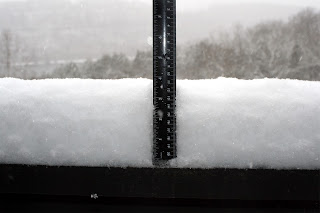
Forsyth MO. - Beginning sometime early on January the 14th, in southwest Missouri, a lot of folks got a real introduction to the winter of 2017-18 with the first decent snowfall in many a moon.

At my station, located in Forsyth Missouri, I was pleased to see this event happen as snow acts as a good insulator for plants and wildlife. (Please see my short video that shows the early onset)! This could prove to be especially important when one considers the brutal temperatures that will be arriving sometime on Tuesday! Also, thankfully, the main street appeared to be in good shape with plows out and about on the side streets. So, a nice looking and non-threatening gift from God that most of us can enjoy!

By the morning of the 15th, the snow had reached about 4 inches as of 10:00 AM with a light snow still falling!