Saturday, December 14, 2013

OK! So, it's gonna be a bad winter!

By most any measurement, the winter of 2013-14 is a bad one...even though we haven't made it to actual wintertime as of this post! So, far, I've recorded ten inches of assorted glaze, sleet, slush and snow starting on December 5th and they tell me there's more to come long about the 19th!

On a good note, it's been quite some time since we saw a decent snow pack this far to the south. Snow is a good thing as it insulates the ground living organisms while also providing a slow release moisture system that feeds animals and plants alike!

On the bad side of things, the thermometer has already dipped down to just a couple of degrees above zero with the average low since the 5th at around 15F. That much cold has only served to keep my furnace running nonstop and will, I'm sure, reward me with a large electric bill at the end of the month!

Tuesday, December 10, 2013

Early December 2013 Weather Stats

Well, has this December's start been significantly different from 2012? You bet your britches it has!

Last year, December 1 to 9, the average high was 63°F versus this years 43°F – that's a full 20 degrees colder! And the lows? This year's 26°F versus last year's 44°F was also significantly lower. Another obvious difference is the snow pack that fell on the 5th and which is still hanging around as
of the 9th! A situation that may persist through the next coming days, but which will likely dissipate right before the 13th when more snow is forecast! And, oh yes, we are still some ways from the official start of the winter season!

Both this year and the last were also a bit stingy in the rainfall department, with December 2013 at .61 inches versus the same time last year at .54 inches. 

Monday, December 2, 2013

December 5th weather may be mixed!

The first Thursday in December 2013 looks like it might get a bit interesting as the national Weather Service does not have a good handle on the precipitation types that may impact parts of southern and southwestern Missouri. Depending on the exact nature and depth of a 'warm nose' that will be draped over the border counties between Missouri and Arkansas, there exists the possibility for ice accumulations late Thursday, especially on elevated surfaces. At some point, this dome of warm mid level air will get pushed to the south. And, at that time, any additional precipitation would then fall as snow. Let me see...snow over ice...not a good idea! That said, accumulating snow is still expected across the entire area with the heaviest amounts falling from late Thursday into Friday morning. The snow will then taper off from west to east Friday afternoon.

Bitterly cold temperatures will then settle on in for Friday and the weekend with highs only in the mid to upper 20's! Overnight, the mercury may bottom out somewhere in the single digits and man, that will be pretty darn cold!!! But wait! Yet another frontal system may come through the area on Sunday, and while it isn't forecast to be as strong as the previous system, any additional stuff that falls from the sky will be in the form of snow and could add to the snow pack!

Anyway, a rather wintry start to the month!

Monday, November 25, 2013

The weather outside is frightful, and it's still November!


More than a half-foot of snow fell across Pueblo, Colorado on November 23, 2013 in a winter storm that's part of a system that headed to North Texas and which will impact the East Coast on Thanksgiving!
With Thanksgiving 2013 just around the corner, I thought it might be fun to think a little about December and some weather trends of note.

One of the great things about being an ordinary and non-professional person is the inability of most everyone to hold me to account when I make my weather predictions! While I'm certainly no expert, I am colorful! Way back in August, I made some predictions about what I felt was to come for the winter season of 2013-14. And, I think I mentioned that we might get some 'weird weather' in the form of ice, snow and even record cold. (For their part, the weather service is calling for a rather dry, non snowy and warmer than normal December and January). How boring!

Well, here it is, late November and already some exposed surfaces have been 'exposed' to ice! Close locations, like Arkansas just to our south, have also experienced the bite of winter with much colder than normal temperatures and even a little ice storm thrown in for good measure! Texas, unfortunately, got clobbered with a storm that has left 8 dead as of this post. So, yes, things are getting a little weird out there and that weirdness is starting a bit early! Early and persistent cold conditions across much of the Midwest have helped to set the stage for some potentially exciting times later in the season! Stay tuned, as things may only go downhill from here...

Saturday, November 23, 2013

Coldest air of the season due to impact Forsyth MO area!

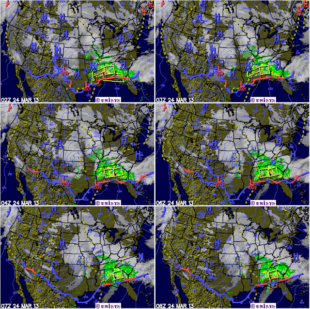
It's getting harder and harder to tell that it's still only mid fall when the weather service is forecasting single digit temps for some people living in southwest Missouri overnight on November the 23rd and 24th! The culprit is a re-enforcing blast of arctic air that is streaming in from Canada and which was posed just to the north of Forsyth Missouri in the early morning hours of what could have been an otherwise great Saturday! (A fact that is evident in the radar map pictured below! 

Once that frigid air gets to our area, moderate winds will help to make just about anyone who ventures outside miserable. Those living in low lying areas will also be the unhappy recipients of the coldest air as it will tend to pool in those locations.

Best advice! Hunker down, turn up the thermostat and throw a few extra blankets on the bed before retiring later this evening. 

Friday, November 1, 2013

October 2013 weather recap!

Forsyth MO data
It was hard for me to believe, but last minute rainfalls towards the end of the month made up for what I was sure would be a deficit. Here in Forsyth, I had 3.68 inches in the rain bucket versus a historical average of 3.39 inches. What's more, this rainy pattern looks like it just might persist on into the month of November!

Temperature wise, we ended up about normal at -1 degree below the average for the month. (Those warm 80 degree days we had at the start were overcome be a decidedly cool trend starting on about the 16th). The average high was 67°F while the average low was 46°F. This was 4 degrees below and 3 degrees above the normal readings respectively. (I'm sure the global warming theorists will have a field day with that stat, although all the readings were well within the 'normal' range').

From an electrical power use standpoint, I used only 463 kWh (~ $65) of electricity for the billing month versus a last year's use of 403 kWh. This was very acceptable, especially considering the 7% rate hike we all just endured for Empire Electric users. I'm also looking forward to enjoying significant energy savings during the more challenging winter months yet to come. Please see my Energy Blog for more on some of the energy saving moves I plan to be making this coming winter.

Wednesday, October 23, 2013

November's coming! Surely my favorite month! Not!

I've always touted the month of November as a transitional month as it generally starts out pretty nice, but then it starts to develop an attitude towards the end. The month itself is 30 days long and during that period of time, the mean or average temperature goes down ten whole degrees from 57°F to 47°F., and I can tell you from experience, that represents a big change in terms of a person's overall comfort.

Most of my 'personal discomfort' comes from the overnight lows and not so much from the daytime highs. In 2012, the average daytime high was 58°F ,which wasn't all that bad! The lows, however, tended to hover around the freezing mark which was definitely a bummer. The sun goes down and wham-bam, thank-you-ma'am, it's friggin freezing! Ah yes, and speaking of those sunsets – they come too darn quickly for my taste. After the time change on November 3rd, (you know, that's when we all fall back), darkness comes much earlier. By mid-month, you might well be at work when it's already getting dark out there! Adding insult to injury, it may also be pitch black when you get up! (They call this 'daylight savings time', but seriously, who's really getting those savings)?

Anyway, as I alluded to, the month is a definite transition for many. When the sun's not in your eyes (because it's so low in the sky), you're being rained on, and it's often a cold rain at that. We average about four inches down here in southwest Missouri and on some of those special days you can start you day by dressing in the dark, going out into near freezing weather and driving to work with a pelting rain that threatens to turn to ice at any moment. Yes, my friends welcome to the month of November....

Thursday, October 17, 2013

Get out! It's Fall already?

For those who watch the weather as closely as I do (it's a sickness), you would have taken notice of the subtle change in the weather patterns over the past week or so. The most obvious of these would be the fact that the nighttime temperatures, which had been running a number of degrees warmer than normal, are now beginning to come more in line with seasonal averages. This 'chilling' effect was also reinforced by a corresponding dip in the highs that have caused the average trend line (see graphic above) to dip even lower that what we experienced at this time last year. And, this trend of Mother Nature getting her winter garb on also looks to be de rigueur for the immediate future as a series of cold waves from Canada look to be set to invade the Heartland of our country. (Here's a bit of advice, anyone with stuff left to harvest from their gardens may want to get right to it)!

Look for an early frost well before Halloween and maybe, if we're lucky, a nice autumn display of leaves as they change into glorious color before falling.

Monday, October 14, 2013

Mid October 2013 weather report!

Click on graphic to enlarge
It's mid October down here in southwest Missouri and while some leaves are now falling, most of the area is still bathed in a green glow. I'll try and enjoy it while it lasts!

The first half of October was very pleasant with the average high temperatures at 74°F which was some 3 degrees above where they have been historically. The lows were averaging 53°F were 9 degrees above the normal! Wow! This made for some really spectacular days that afforded many residents the opportunity to get in some RR outdoors before things get a little bit more nasty later in the season.

The rainfall, so far has been lagging just a bit behind the thirty year average. I've measured a total of 1.44” on my weather web page which just a bit behind the average for the month. I confident we'll make that difference up by the end of the month.

Look for the second half of the month to be colder than normal with increased chances for rainfall interspersed between numerous cold fronts.

Sunday, October 6, 2013

October's temperatures seem to be going downhill!


While I was going through some data I wanted to use in a future article, I came across some rather interesting information. It seems that, at least as far as the mean monthly temperatures go, the last three Octobers have gotten progressively colder! Now, of course, three years does not make a trend by any stretch! But, it is a little odd considering all the hype concerning Global Warming that the media seems to love so much.


Now as you may or not may know, the truest indication of a warming or cooling trend can be seen in each evenings lows. That's because Global Warming, per sae, works during the nighttime hours and not the day. This quote was taken from 'The Sun's Heartbeat: And OtherStories' by Bob Berman. “Unlike the other climate influences, greenhouse gases overwhelmingly act on the colder half of our planet, and the effects manifest as a rise in a region's minimum temperatures. Carbon sneaks in and does its work at night.” So, here is a graph of the mean low temperatures for the past three Octobers. So, is it getting COLDER at night? Interesting!

I'm looking forward to seeing what transpires in this still young month of October 2013!

Saturday, October 5, 2013

And so fall begins!

[Forsyth MO] – At 6:50 AM the first splattering of rain fell outside my window. The temperature was a comfortable 68°F. The overcast sky was heavy laden with moisture, a fact that presented itself in the form of copious rain that fell throughout the morning hours. By 9: 00 AM, .6 inches of rain had fallen from a vigorous frontal system that was training over the are. Occasionally, deep-throated thunder sounded off in the distance. Meanwhile, up north of my position, heavy snow had fallen in
Boulder Canyon, ND
numerous states. As much as two feet or more in places like Boulder Canyon, North Dakota. Down to the south in the Gulf of Mexico, a tropical storm name Karen churned towards the coast spewing out copious amounts of rain on its shear-torn leeward side. Yes, fall is a time where you can witness all sorts of wild weather as cold Canadian air tries to mix it up with warm and moisture laden air from the Gulf.

Friday, October 4, 2013

Truly amazing times!

'Blizzards to the north of me
Storms to the south!
And with all that chaos in Washington
Think I'll just hide out!'


Those are my sentiments as the first weekend of October is just a day away! Mother Nature is sure making a statement with the first winter storm of the season called Atlas as she deals out heavy snow in many of our northern tier of states. Off the the south, in the gulf of Mexico, tropical storm Karen is churning away and looks to be making landfall at some point on Saturday. Thankfully, it appears as if shear forces are going to significantly downgrade the amount of mischief she can do.

Here ins southwest Missouri, all is quiet as we all await the arrival of the first real cold wave that is currently draped from New Mexico all the wave over to Michigan. Behind the front is some decently cold air that is forecast to sag it way on into the Taney County area of Missouri sometime during the early hours of Saturday – I can hardly wait.

Washington D.C. will also be entering its fifth day of being shut down (courtesy of President Obama and his stooge Harry Reid). I'm told by some in the media that its likely that the shutdown will continue well into the month and will likely become rolled into the budget ceiling debate starting on about the 15th. Just like a powerful storm, this debate may cause our nation great amounts of destruction, so be sure to have you larder full of food, just in case....

Thursday, October 3, 2013

First cold jolt of the autumn season 2013-14!

Click on to enlarge!

I will be watching with some interest as the first cold wave of the early autumn season impacts the Midwest on the first weekend of the month of October 2013. Temperatures may struggle to reach the low 60's lows during the daytime on Saturday, Oct 5 with temps only in the high 30's come Monday morning, October 7!

As you can see in the chart above, we were considerably higher than the average temperatures of the last year. This trend should hold through Friday, at which point a cold front will move on through the area and will cool things down. What is not clear, at this juncture, is the possible effect of the yet to be named tropical storm that will be called Karen if her winds increase a bit more than the 60+ knots they are now. As of this post (Oct 3), she is churning her way up toward
Snow, severe weather and a tropical storm all on 1 map!
the Gulf of Mexico where it is thought that she may well strengthen into a full fledged hurricane. And, while most computer models have 'Karen' veering off towards Florida and the east coast, there is still the possibility that she will maintain a more northerly course and thus could impact the weather over Missouri. (Right now, that's just conjecture on my part).

In any case, look for a wild ride this fall and winter as Mother Nature may throw a tantrum or two, just to keep things interesting!

Monday, September 30, 2013

September 2013 Recap!

A corneal mass ejection (CME) from the sun could be headed our way!
[Forsyth Mo.] While we all languished in the midst of a very quiet solar max cycle 24 (not counting this massive corneal mass ejection on the 29th), September 2013 rolled on through without a hitch. Like the lack of sunspots, the month of September was most notable for the absence of any extreme weather! (Heck, most of those days could best be described as stellar)! The daytime high of 83°F, while overnight lows came in at a very comfortable 60°F. The two combined averaged at 70.3°F was only 2°F higher than the 30 year temperatures here in Forsyth Missouri averaged out at 83°F versus a


historical average of 68°F. So, all in all, it was not a bad month to get out and about. Even the rainfall was a modest 3.10" (which was .92 below the normal of 4.02) inches here in Forsyth yielded a yearly total, so far, of 34.50 inches versus a historical average of 33.98 inches! Happily, all these figures are well within what I'd call 'normal'.
 
As we now bravely enter into the month of October, I can't help but wonder if the coming months (especially December through February) will be much colder than normal? According to the Farmers Almanac it will be.

Winter temperatures will be colder than normal, especially in the north, with the coldest periods in mid- and late December, early January, mid-January, and early March. Precipitation will be slightly below normal in the north and above in the south, while snowfall will be below normal in the central portion of the region, but above normal in the north and south. The snowiest periods will be in early November, late December, mid-January, early to mid-February, and late February.”

It's possible that the month of October may give everyone a preview for what can be expected later in the season. (Look for colder than normal temperatures for a start). In addition, the lower than normal sunspot activity and increased levels of volcanic dust in the air globally, may favor or lean towards a particularly harsh winter. (Then again, perhaps the CO2 levels that are approaching a record high of 400 ppm might bail us out yet again). Time will tell...

Sunday, September 15, 2013

What's in store on the weather front?

Just in case everyone needs a heads up, it's now almost fall! The official start will be September the 22nd. What that means is that pretty soon, the trees will turn colors and then the leaves will begin to drop, leaving stark and bare skeletons behind. To me that's a little sad. I love all the greenery that is the backdrop of all that I do for most of the year, and I hold a grudge against nature when she turns everything brown. (Did you know that the color the sun puts out the strongest is the color green! It's the last color to fade to gray when the suns sets each day)....

As you might guess, fall also means that the sun provides a little bit less warmth as the days become shorter and shorter, until around December the 22st, when we arrive at the winter solstice and so experience the longest night and shortest day of the year. Before that point arrives, our warm and balmy days of late summer will gradually turn into the cold harshness of winter. all of which starts happening right about now...

So, what's in store for this year? Will it be a typical fall and winter or will things get perhaps a little bit dicey with a either a warmer or colder than normal regime than what we are used to. Certainly, what with global climate change, all the talk of the town, we might expect it to be warmer each winter as the levels of carbon dioxide approach and then surpass the 400 part per billion level (we are currently at 393.05 according to the Keeling Curve). Yet, scientists insist that during periods of true climate change, the one constant is that there is no constant. Rather, they tells us to expect weather that might well swing wildly from one extreme to the other with no discernible pattern, rhyme or reason. And maybe that makes some sense, after all. Our planet's day-to-day weather is the result of an extremely complex interplay of forces working on a grand scale. And much of the input of raw energy into that system comes from a star we call the sun. Her constant outpouring of life giving heat and energy is what makes life possible and is what drives unimaginably huge forces at play on earth. No one man or women knows or can predict the end result of the interplay of solar insolence, volcanism, green house gases and ocean currents on the coming season. The best they can do is to tell us all to buckle up, for it's bound to be a wild ride no matter what!

Monday, August 26, 2013

My winter 2013-14 weather prediction for North America!

NOAA has released its graphs for the winter forecast of winter 2013-14 and I'd say it was rather boring. Precipitation – average, temperatures – average. Well, you get the picture. On the other hand the newly released Farmer's Almanac is going to the extreme of calling for really COLD conditions!

So, who's right?

My best guess is that the reality will lie somewhere in between. But, let's take a look anyway at four of the things that actually do influence our global weather from time to time:

Solar insolence – This is a fancy way of talking about how much heat old Sol puts out. Right now, we are climbing out of a rather prolonged and wimpy solar maximum that has not seen much in the way of sunspots, solar storms or anything else for that matter. Historically, when the sun behaves this way we can look for cooler weather globally.

ENSO – The  El Niño Southern Oscillation refers to variations in the temperature of the surface of the tropical eastern Pacific Ocean (warming and cooling known as El Niño and La Niña respectively). We have been locked in a ENSO neutral phase for quite some time and it looks like that trend may persist on into the early portions of the coming winter. So, to me, that implies a more or less average influence for cold winter-like conditions. Neither good or bad.

Vulcanism – Of the eighty or so active volcanoes located all around the world (any one of which can go bonkers and spew enough particulates into the atmosphere to cause a measurable drop in temperature), it's a throw of the dice. When, where and how severe such an eruption might be is very uncertain and so this is a climatic wild card in the deck that could change the dynamics of our coming winter overnight.

CO2 – Carbon dioxide is a so-called 'greenhouse gas' that has been steadily climbing ever since the Industrial Revolution. It's measured in part per million (ppm) and in lieu of the presence of mankind, would read at around 272 ppm. The official level of the gas in our atmosphere, aka the Keeling Curve, put it at 394 ppm when this post was written in late August. That's higher than it's ever been over the last three million years and, yes Victoria, it does play a major role in warming the earth's atmosphere!

Taking just those factors into consideration, (I've left out the Milanovitch Cycles for this discussion), I've come to feeling that this winter will be a little on the cold side, but still well within the historical averages. That said, (the fly in the ointment being CO2 and the anthropogenic climate forcing it causes), we may see some really weird winter storms this time around. Time will tell...

Monday, August 19, 2013

Could dust from forest fires be causing some local climatic effects?

The jet stream is superimposed over a map of recent forest fires.
Are recent forest fires dumping inordinate amounts of particulates high in the atmosphere that are being carried aloft over mid western states?

For anyone who's lived in southwest Missouri for some time, they can attest to the fact that this August has been somewhat unusual. It's been notable for two reasons; more rain than average and cooler temperatures. Here in Forsyth Missouri, we garnered 5.49 inches of rain (through August 19th) compared to an average of 3.15 inches according to the 30 year historical standard. Other nearby locations, such as West Plains, have had over ten inches! Could part of the reason for all this rain be the extra dust coming our way from the persistent forest fires in western states? I don't know.

In addition, August is normally thought of as a really hot month (think Dog Days) and in this respect too, it's been something of a disappointment. The average daily highs have averaged 7°F below average so far this month. Could that have been partly the result of extra dist particles in the air? Once again, I'm not sure. But, it's still interesting to speculate.

Monday, August 12, 2013

A wacky August 2013!

"I'm always attuned, these days, to any sort of internet story concerning the ill effects of global climate change. Whether it be real change or imagined change, I often wonder at what point weather scientists will be able to say that the climate is or is not moving in a direction that would impact humanity in a bad manner. Thus far, that day has yet to arrive..."

By most statistical criteria, this August has been somewhat strange. Whereas a typical August down here in southwest Missouri sees lots of hot and dry days (the so-called dog days of summer), this month (through the 11th ) has not followed anywhere near true to form. Beginning late in July, the entire region became entangled in a wet patterns that saw rain fall just about every day. Where I live in Forsyth MO, we've had 5.60 inches of rain with places just to the north and west seeing much higher amounts. (The West Plains weather station has recorded 10.6 inches thus far in a month that historically sees only about 3)! This hefty amount of water has now also caused flooding to occur in locations close to my home (see above) including cities like Hollister where a flood swallowed a home and Branson.

Rainfall means cloudy skies and due to the persistent cloud cover, our temperatures have responded by being cooler during the day and warmer during the evening hours. (The actual variance was 6 degrees Fahrenheit cooler for daytime and 6 degrees Fahrenheit warmer at night). Just what you might expect with all those clouds hanging around. The end result was a statistical wash as the high and low have canceled themselves out. This resulted a 'normal' average reading for the month, even though it's been pretty cool! Like I said earlier, wacky!

The really interesting thing about this month will be; a, to see how it turns out at the end and b, to see if the cooler and wetter trend will continue for September and beyond.What? Is that the sound of thunder outside my home? Why, yes it is...

Tuesday, August 6, 2013

Will area parks flood in the fall of 2013?

Water levels above 668' will insure some flooding
After a couple of bouts of heavy rainfall early on in August, a couple of people inquired as to the possibility of some flooding occurring in either River Run or Shadow Rock Park. These two, side by side, parks are popular spots for campers and RV'ers who visit the Forsyth area in here in southwest Missouri. This year has seen a steady stream of vacationers with the best of the fall season yet to come.

Now, as I do not proclaim to be any sort of meteorological or hydrological expert, my opinions carry
Boat launch at River Run Park
little if any (ahem) water. But, living right next to the Bull Shoals river way does give me a chance to view the water levels on a day to day basis. And, this year, close to and slightly above normal rainfall has lead to water levels that have hovered at or near the 665 foot mark with 654 feet being the lower limit of the so-called 'flood pool'; a target level which the Corps of Engineers strives for. The above graphic shows, we've been above that level for most of the summer. Now, what with all the rainfall across the much of the southern portion of the state, these levels are sure to rise over the next week or so. A situation that would only be exacerbated if more rain does fall as predicted by the weather service.

The bottom line, in my opinion, is that we stand a good chance of seeing some flooding of the River Run side with little or no flooding of Shadow Rock Park.

Sunday, August 11 Update: The water level at Bull Shoals hit 664.60 feet this morning and as you can see some of the lower parts of the park are just beginning to flood. I'm guessing that no real problems will be encountered until the level hits and surpasses the 670 foot mark. At the current rate of water level rise (.82' per day) that would be on or about the August the 18th.

Monday, May 6, 2013

The low that wouldn't leave!

Early in the month of May 2013 on May the 3rd, a very vigorous low pressure system dropped down into the Midwest, bring with it all manner of nasty weather! Many of the northern states, including parts of Missouri got the added insult of heavy snow at a time of the year when such nastiness is exceedingly rare!

Then, ever so slowly, that pesky low pressure system has moved off to the east. So slow has been the movement that even now, on May the 6th we are still feeling the effect of a system that is currently parked over the great state of Tennessee. Systems like this are what have made May a wet and cool month!

Friday, April 12, 2013

Midland's All Hazards Weather Alert Radio!

Out of respect for the sort of severe storms my home in southwest Missouri is subject to, I decided to purchase a weather alert radio from Midland Radio Corporation over the internet. The model I selected was the WR300. It sells for about $44 at the time of this post and had some features I though might prove useful.

In addition to being a weather radio that receives the 24/7 broadcasts from the National Weather Service, the WR300 also is a radio alarm clock that can wake you with nice gentle music from the station of your choice or by a blast from a siren. Take your pick!

Yet, what I found to be really cool about this unit was the fact that it employs S.A.M.E or Specific Area Message Encoding, which enables the user to target only the county they reside in (or up to 23 adjacent counties) to receive notifications of impending severe weather. This is a great feature in that it allows one to filter out warnings when storms may not even be near where you live. I was surprised to find out that not only will it notify a person of the threats of winter storms or tornadoes, but also of over 60 other hazards including dust storms, floods, law enforcement and even biological hazards to name a few!

With it's ability to use battery backup, you can take this radio with you wherever you travel. So, it makes a great companion for anyone that travels for a living! The folks at Midland thought of everything with this product. It even supports and optional external strobe light to be used in loud environments or in homes with hearing impaired people present.

You definitely get a lot of bang for the buck with this unit and I would recommend it to anyone out there who knows that in the event of a severe weather outbreak, that seconds count!

Monday, April 8, 2013

First week of April 2013 Wx Summary

After suffering through a much colder than normal (-4°F) month of March, it was with no little relief that April arrived right on time. Interestingly, the first seven days were more in line with the trend established in March than what one would expect from it being April! The average temperature for the entire month of April is 57°F (West Plains MO data) with the Forsyth area registering 3 degrees below that level at 50.1°F. The average high temperature was 63°F and the low was 38°F when the normal for this month would be somewhere around 69°F and 41°F. So, we have some room to make up.

Precipitation likewise has been lagging behind with the historical average for the first week at .92” (4.33 for the month). We’ve had just .33 inches in that first week and so also need to catch up. (Something that could well happen in week two).

Tuesday, March 26, 2013

Check out this graph of temperatures!

Click on to enlarge
Hard to believe, but just a year ago, we we all basking in relative warmth as the high temperatures hitting the 80 degree mark on a regular basis! This March has definitely not been much of a prize with the last nine days (starting on the 17th), seeing high temperatures that were colder than the daily lows were last year!

And, it looks as though, over the coming week, this trend will be staying pretty much the same. With only a couple of exceptions (Easter Sunday the 31st and Monday April 1) we will still be hanging out in the fifties before moderating upwards to where we should be as we get into the month of April.

More local weather is available at www.taneyservices.com!

Sunday, March 24, 2013

Last winter storm of the year blows on by!

What I think everyone hopes will turn out to be the last snow of the winter season, (it is spring after all), was a bit of a fizzle for us down here in southwestern Missouri and even more so if you lived near the Arkansas border.

Temperatures that held pretty steady at the forty degree mark provided just enough of a cushion to hold back what could have been another few inches of the white stuff. That would have been a second dose within a week and just days after the official start of the spring.

Now, all eyes are turned to the last week of March when a slow and gradual warm up is forecast. After temperatures that hovered below the forty degree mark for much of the prior week, a few days of sixty will feel positively bodacious!

On a more positive note, we are getting rain every few days as the atmosphere remains unstable and pulses of energy continue to move through the region. West Plains has recorded 3.23 inches of precipitation for the month while Springfield stands at 3.66 inches. Both these readings place this area ahead of normal rainfall amounts for the month to date. (My reading at Forsyth of 2.65 inches shows us to be lagging just a bit behind). And, with more rainfall forecast over the next seven days, it looks probable that we will close out the month at close to normal.

Saturday, March 23, 2013

Crawling ever so slowly to April!


Like a man who’s been lost in a cold an inhospitable desert for too long, but who now sees an oasis just ahead, he crawls slowly towards salvation.

That man is me and I’m hoping the month of April turns quickly to be the warm(er) salvation I so desperately need! Well, OK, so it’s not been all that bad a winter. But, it’s been a long one, as far as I’m concerned. March, circa 2012 was 12 degrees warmer than normal and other than the complaining of some fishermen, it was an awesome month. This March of 2013 looks destined to be some 5 to 6 degrees colder than normal and so the word ‘awesome’ has not come to my mind. Other descriptors have, but not that one.

It’s comforting to know, then, that the average temperature of April, jumps upward some 13 degrees! A figure that should kick some serious temperature bootie. And when that happens, SPRING will start to happen with all the subtlety of a freight train! Can’t happen too soon for me.

Friday, March 22, 2013

Another Winter Storm Coming? What!!


What’s wrong with this picture? The weather service out of Springfield is forecasting yet another blast of cold arctic air coming down from who knows where (probably courtesy of those mean old Canadians). That front will meet up with a glob of moisture (from the Gulf?) and will cause even more havoc in what is currently a soggy and wet southwestern Missouri. This blessed event is to come right on the heels of a snowstorm from just a day ago! ‘Heavens to Murgatroyd’, if I might quote old Snagglepus!

Yes, it appears as though parts of Missouri, especially the northern parts will get another dose of Old Man Winter on Saturday and Sunday. This storm system, which is currently hiding out in the Rockies, is due to strike the Midwest sometime on Saturday, March the 23rd. Acting more like a classic mid-winter storm than anything else, counties to the north of Forsyth will see the most action, with our area spared the worst effect. As a matter of fact, if we get lucky, all that will fall down this was will be rain! (Well, do you feel lucky punk)?

Wow! What a great snowfall!


This morning I got up and measured the snow depth by my house and came up with 4 ½ inches! There also seems to be a glaze of ice over the top so my advice to anyone this morning, would be to at least wait for the plows to come through before attempting to leave your home. While I’m not sure of the conditions in cities like Branson where they may have salted the streets and such, I can say that the rural areas will more than likely take a bit of time to clear. On a good note, this snow looks like; 1) it would make great snowman making material and 2) like it won’t be around long as temperatures should rise up to close to the 40 degree mark later today! For more, go to www.taneyservice.com!

Tuesday, March 19, 2013

Snow to our north and rain in Forsyth?


When the National Weather Service uses the term ‘the devil is in the details, that’s their code way of saying, ‘we ain’t got a clue’; and that is the case with a very complex system that will affect parts of southwestern Missouri over the next 48 hours or so. In a nutshell, Missouri will be center stage for the coming together of cold air and warm Gulf moisture. A situation that would normally imply frozen precipitation of some sort were it just a bit earlier in the year. But, seeing as it is the later part of March, thermal profiles will play an increasingly important role as to what actually ends up falling from the skies.

That said, I have a feeling, call it a gut feeling that the inclement winter weather will sag just a bit further to the south than what the weather service is currently indicating. I’ve reflected that in the graphic above and yes, much will depend what can be termed as a ‘warm nose’ of air that may well push its way across the area in the middle of the evolving events. Should that happen, it would be an all rain event with little if any snow.  

Saturday, March 16, 2013

March Weather Madness!

Of all the months of the year, March holds the distinction for being the most changeable when it comes to hot and cold changes! After two back to back warm (even hot) days, the winter weather switch is about to be flipped as a colder frontal system comes barging into backyards where us men are desperately trying to get their early weekend barbeque started.

With the much colder air will come the real possibility of copious amounts of (much needed) rain. As much as an inch and a quarter is being forecast by the National Weather Service for some spots around the Forsyth area overnight tonight and into Sunday.

But wait! There’s more. As the coming week wears on, it will be the 50’s as usual with another blast of even colder air arriving around midweek. And yes, boys and girls, snow may even be in the forecast for the Thursday to Friday time frame.

Well, it is March and warmer days are just ahead! We hope!

Thursday, March 14, 2013

Countdown to Spring!

Note that the above graph shows average temperatures!
With just seven more days to go before the official arrival of spring on March the 20th, I've got some good weather news. Temperatures, which had been averaging 6 degrees below normal are forecast to do a 180 and jump up to 6 degrees above normal. Be still my yammering heart! In the graph above the blue line represents the next 8 day average of about 51F while the dashed line is the normal average for this time of year.

The only fly in the ointment will be the rapidly increasing juniper, oak and maple tree pollen levels. The bane of allergy suffers like myself! This picture a juniper at right illustrates the point. They all look brown, not because of dead limbs, but due to massive loads of pollen that they are getting ready to unleash upon the world! (These high pollen levels will be pretty much be the rule for the next few weeks with only occasional rains to help knock them down).

So, for the most part, it's a win-win situation as it warms up out there and all those neat signs of spring begin to happen. Before we know it all the trees will be leafed out and the area will lose that brown drab look it's sported all winter long. That will signal to me that it's time to sit outside in my back yard and light up the barbeque!

Monday, March 11, 2013

March 2013 on track for mid-month warm up!

Down where I live in southwest Missouri, the temperature trends are right in line with historical averages. While we started the month on a very cold note, things have quickly gotten back in line with a first week average temperature of 38°F. The second week (of which we're halfway through) is currently running at 49°F. and the projected average for the third week looks to be about 55°F. That's encouraging! As soon as the mean temperatures gets up to and past the fifty degree mark, the ground outside warms to the point where new plant growth begins to accelerate. Not surprisingly, protected south facing spots even have a few daffodils now in bloom!

The only potential fly in the spring ointment, will be any possible effects of global warming which may have been responsible for some strange weather in the past. A case in point was last March, which was twelve degrees above the historical average! Talk about a warm start to spring! We then went right from there onward to a very dry and hot summer. As a result, many cool loving vegetables like onions and potatoes really suffered. This year, at least so far, we are right in the sweet spot of what is considered normal. (And yes, even our rainfall has been adequate)! I'm hoping these trends continue.

Friday, March 8, 2013

Warming trend for March continues!


The warming trend for southwestern Missouri will continue on into the second week of the month as mean temperature reading in the fifties begin to show up more and more often. Anytime the fifty degree barrier for an average is broken, you can expect relatively nice days in the mid to upper sixties on most days! This kind of weather is good for everyone as it allows us to all get outdoors and exercise a little bit more than we might in colder times. Note that we are still way off the pace set in 2012 when that month averaged 12 degrees above normal!

Sunday, March 3, 2013

By golly, I think it's going to get warmer! And yes, it will!

A13 number in blue = forecast means or averages.
After suffering through a week, lo these past seven days under overcast skies and much colder than normal temperatures, we may be getting a break. Believe it or not, there are some sixty plus degree day starting tomorrow on Monday, March the 4th! (Be still my heart)! And, the trend only seems to get better as we 'march' through the next seven days!

For sure, when you compare the temperature variances with last year, it really sucks, but last year was a barn burner month that averaged an unheard of 12 degrees above average! So, if this coming week is at or a little bit above average, then we should still be thankful. Yes? No?

the only thing missing, at this point in time, is the lack of a good soaking rain. However, it's early in the month and that may change quickly!

Friday, March 1, 2013

February 2013 Wx Summary


Click on to enlarge

Believe it or not, this past February in Taney County MO was somewhat warmer than average. Hard to reconcile that when the last week of that month was so cold! Truth is that the month ended with an average of 38.2°F versus a historical average of 37.9°F (West Plains data). More surprising, (or not for all you global warming theorists) was the average lows which came in 5 degrees warmer than the 30 year average. Wow!

On another and happier note, rainfall totaled 3.14 inches at my location in Forsyth Missouri (DanO’s Place) and so exceeded the published West Plains average of 2.84 inches for the month. That will be good news for local farmers as we seem to be holding our own for at least the first couple of months of the year.

Monday, February 25, 2013

It’s good to be on the warm side of a winter storm!


After receiving a glancing blow of ice on February the 21st, it’s sure nice to duck another bullet as a winter storm, that may bring blizzard conditions to eastern Kansas, looks to enter our area on the 25th. While heavy snow accumulations may be the norm for far western portions of Missouri, down here in the southwest, we are looking at just a dusting if even that!

Saturday, February 23, 2013

February ending on a cold note!

It looks to me that February 2013 may turn out to be pretty close to average when compared to the historical averages; this after we started the month on a warm footing, statistically speaking. Even though there is still a week yet to go, my thinking is that we will end the month pretty close to the mean average of 37°F (West Plains data) and we’ll get there by finishing the month much colder than what would normally be the case. That also seems to be the trend with computer models now suggesting that March will continue the trend with temperatures coming in at 12 to 15 degrees below normal for the first week! Ka Brrr.

Side note: Last year, March was quite a bit warmer than normal at 12 degrees higher than the historic average of 47.5°F. Wow – that would sure be nice to see again! With an average high of 71.2°F; that was a month where most any day, you could get out and about sans jacket or coat! I’m afraid that will not be the case this time around….

A Winter Wx Storm double dip?


Now after the bulk of the winter of 2012-13 has come and gone without nary a flake to be seen, comes back to back ice and snow in late February?
 
The National Weather Bureau is once again posturing and couching their wording when it comes to describing a frontal system that is due to nose into our area on Monday and Tuesday of the coming work week. A key phrase in their wording is the concept of ‘shifting south’, as in ‘the accumulation of snowfall will increase (a lot) should this system shift further to the south than what the computer models currently predict.’ (Wording that once again reminds me that weather forecasting is more about probability then it is about certainty).

Just prior to this potential winter storm should be a relatively decent Sunday. A day that will give all of us home bound folks a chance to get out and frolic in temperatures that could touch 50 degrees! (Be still my frigid heart). Then, it’s back into the house to stoke the fireplace and await whatever the forces of nature will bring. And, everyone please take heart - spring is just a few weeks away!

Thursday, February 21, 2013

The ice storm that really wasn’t!


When I were to think about all the really bad possibilities this latest winter storm presented, I'm very thankful for all that it was not.

Promptly, at 6 AM this morning, I was wakened from a sound slumber by a crack of thunder just outside my window. Shortly afterwards the skies opened up and honest to goodness thunder ice was falling all about my house located near Forsyth Missouri. (Had this persisted more than a few minutes it would been a true disaster as very quickly every surface was covered with a sheen of ‘lumpy’ ice, or more technically, a form of sleet called graupel)! Thankfully, a dry slot appeared and gave the area a nice reprieve from about six to nine AM.

At 9 AM, I ventured outside to check on the street in front of my home and found it to still be ice covered. A radio station, KRZK, earlier informed me that most of the main roads were clear and that was a comforting thought. So, even with a strong wind coming out of the east, I felt that perhaps the worst of this storm was over and done…. and then I heard more thunder!

By 10 AM, the skies were once again becoming dark, or at least darker than they had been a short time before. The mercury which had been slowly climbing had also started to slide downwards a bit and a glance at the local radar was not very re-assuring. (Even the radar was slower than normal to refresh – a hint that a lot of people were accessing the same site).

At 9:56 AM a hard shower of sleet came through and then quickly tapered of to a light drizzle of ice. I reflected that it was actually good thing that the air outside was cold enough so that we were getting ice rather than freezing rain at that time!

This pattern of on again off again precipitation was to be repeated for the rest of the morning, depositing just enough sleet and freezing rain to keep the secondary roads in my area ice covered! Chatter from a police scanner located close by also informed me that the roads were pretty much free of civilian vehicles -  a sign that most everyone heeded the warnings that had been posted earlier.

So passes our first real winter storm of the season. Now, if it would just warm up enough on Thursday to melt all this stuff, I'd be a happy camper!