Monday, May 30, 2016

Post Memorial day weather.


OK, so everyone survived the Memorial weekend in relatively good shape, (I hope). And the weather, while not ideal, was good enough to insure more than a few got a little sunburn from being outdoors. Now, it's Tuesday May 31st and more unsettled weather looks to be making an entrance from the northern Plains!

Looking for pretty wet conditions all across the region for both Tuesday and Wednesday as a rather vigorous frontal system tracks across the northern Plains during this period of time. That will have the effect of pushing a cold front southwards in our general direction. Lucky us, in Taney County, we should remain in the warm sector for both days with the front stalled out just to the north. Not to be unfriendly, the front will send us a series of upper level impulses resulting in heightened probabilities for widespread showers and thunderstorms. That front should go ahead and push on through sometime Wednesday, but at this time our risk for any really severe stuff is marginal at best.

By Thursday, a rather weak shear zone will linger in the area keeping the possibilities of rain to occur in a scattered fashion rather high. This will be especially true for the Taney County area....

A cold front should blast through the region late Saturday ushering in cooler and dryer conditions through mid next week!

Friday, May 27, 2016

My Memorial Day Forecast!


A lot of folks will find that they have Monday, May the 30th off as it is an official holiday. And so too, this date marks the unofficial start of the summer season down here in southwest Missouri. And, since a lot of us will be plating and grilling outside, knowing what to expect from the weather can play a big role in terms of how well that time will be enjoyed!

As I would like to put the best possible spin on that day, I have decided to lie and then hope for the best. I want to say that there will be sunshine, light breezes and warm temps in wild abundance! But, that ain't how things are going to shake out. Now don't get me wrong. Depending on timing, there will be some sun, in between some potentially heavy downpours! But, if we get real lucky, the atmosphere right over Taney County will be somewhat washed out of rain from the storms progged to occur late on Sunday. So, we might see Monday dawn in a pretty nice fashion as the flow of air aloft re-establishes a southwesterly direction and the attendant moisture recharges the air for another round of rain on Tuesday. [Note that the patterns are very fluid and that Monday may just go to hell in a hand basket.....]

Well, that's my forecast at any rate. Just remember that I only play a weatherman on TV and really have no credentials to be forecasting anything, anytime or anywhere.....

Friday, May 20, 2016

Big weather changes in store for last week of May!


Taney County MO – Beginning Monday, May 23, a large trough will develop across the western half of the U.S. This will put our region into an apparent southwestern flow of winds aloft which will bring in a goodly amount of Gulf moisture coming to us on southerly winds. Expect Monday and Tuesday to present themselves in stormy fashion as a result. Also, setting the stage for additional mischief will be a quasi-stationary front off to our west and northwest. This area will then be the source for several impulses of upper level energy that will move out across the flow and which will inter react with the frontal boundary in a negative fashion. This setup will provide us with a number of chances for thunderstorms.

Depending on timing issues and just how those impulse of energy track, there will be the potential for some strong to severe weather off to our west starting Monday afternoonish. How and when these areas will move on to the east is a subject of some debate as of this post. In any case, there exists the possibility for some moderate to heavy rainfall for a lot of folks – thinking 1 to 3 inches with the higher amounts occurring the more west you go. During this period of time, temperatures should remain at seasonal levels - 70's and low 80's daytime with 50's during the nighttime hours.

Update: Sunday, May 22

And so, after a great deal of fine weather on Sunday, the first of what will be several impulses of energy from a large system parked out west by the Four Corners Region will begin to affect only the most western Missouri counties by late Monday morning! The rain clouds should skirt us off to the west and should affect only extreme southwestern MO and then perhaps the central parts of the states later on Monday.

That's how things will remain for much of the rest of the week what with storms showing up here and there in a scattered and a disjointed fashion. We could see some severe action late in the week, perhaps about Friday.... But, please don't get too worked up. At this point many of the dynamic needed for really good storm development is lacking.

Update: Monday, May 23

The forecast for Tuesday through Thursday remains a little muddy due to the complexity of patterns seen by the modeling computers. That said, with the exception of possible storms occurring on Friday, the main threats move out of the area for the weekend with just a chance of some scattered instability here and there. The temps should be near seasonal levels somewhere in the low 80's.

Update: Tuesday, May 24

After receiving a rather limpish 0.08th of an inch on Monday (reminded me of me in bed), the atmosphere was expected to 'juice up' once again with dew points in the low 60's. Later in the day we might see some rain action both to our west and southwest, but it's doubtful we will get much over here in Taney County MO...Think repeat of Monday and you'd have it pretty much covered.... Onward brave soldiers to face another sluggish and overcast day!

Computer models continue to churn out a rather bad ass front set to impact our area sometime late Friday or early Saturday morning, before the whole mess exits the area stage right.

Update: Wednesday, May 25

A few drops expected here and there this date, but nothing like the torrential downpour a lot of us experienced on Wednesday!  Overall weather pattern to remain the same, however. Lost of moisture in the atmosphere, but no really energy packets until later in the work week.

 Out near California is the next packet of nastiness that could affect our little neck of the woods sometime about late Friday or early Saturday depending on just how a billion or so factors shake out....

Memorial Weekend

For Saturday through Memorial Day, pattern changes very little with general 'troughiness' across the west and southwest flow through the mid section of the country. This will keep showers and thunderstorms in the forecast through the period along with a warm and rather humid period. Certainly not everyday will be a wash out as there will be some dry periods, and given flow cannot rule out the potential for some episodes of severe weather as well.

And, here's some more good news, assuming you're all ducks. Apparently this pattern of on again rain will persist through next week!

[This information from the weather service was excepted and then twisted and otherwise mangled exclusively for www.taneyservices.com]

Wednesday, May 18, 2016

Late week frontal passage will lack energy!


Average temperatures 2015 vs 2016 for May 2016

May 18, 2016 - As you can see from the graph showing the average temperatures, we have had our share of cooler than normal weather so far this May! Normally here in Taney County, it begins to warm up to the mid seventies on a regular basis with the night time temperatures falling into the 50's. That hasn't been the case and the lack of significant rainfall has added insult to injury! Sadly, that trend looks to continue for a while longer...

Shake it! Shake it like you mean it!
Beginning on Thursday the 19th, an upper level trough, that is currently malingering over the southwestern parts of the US, will begin moving across our southern Plains and will pass overhead sometime on Friday. As it gets closer to us, the front will cause some atmospheric lifting which could result in a little bit of rain falling in a scattered fashion. But don't expect a lot! This whole system could be likened to an old man attending a polka dance. Lots of desire to move them bones, but the old fires of youth just ain't there in enough force to get the old gent all the way to the dance floor.

After the system passes us late Friday, we can look forward to dryer and dare I mention it, WARMER conditions. Look for mid 70's on Saturday with things getting a tad warmer on Sunday!

Next week will feature the passage of multiple storm systems interspersed with dry periods. Thus, our chances for rain will continue!

Friday, May 13, 2016

Heavy rains possible starting on Monday May 16!


Sometime around Sunday night May 15, Canadian high pressure will start to push east, with flow aloft becoming more zonal (west to east) in nature. A warm front will then start to move back north toward the region, with several rounds of rain and perhaps a few thunderstorms across the area as the front approaches Monday. Computer model guidance then suggests that the front will stall out near the Missouri/Arkansas state line by late Monday night, with several shortwaves interacting with it through Tuesday night. This would likely result in several rounds of rain and elevated convection, though much will depend on the final frontal position. So stay tuned to your local media outlets and bring a weather radio with you if you're out in a boat or camping.

By the tail end of the forecast period, guidance is in general agreement in pushing the front south, with high pressure (and drier conditions) nosing in for a few days [www.taneyservices.com]. Source: NWS SGF

Update: Sunday, May 15 -This from the NWS (some excerpting by me):

'Precipitation chances will increase from the west this evening and especially overnight, as isentropic ascent (the lifting of air that is traveling along an upward-sloping surface) increases ahead/north of a slow moving warm front. Precipitation should initially be in the form of fairly light rain showers, with more substantial rain and a few embedded thunderstorms developing towards early Monday morning.'

While widespread rainfall is expected, amounts will be limited to a half inch through Monday afternoon as instability to remain virtually non existent due to poor lapse rates and lack of supporting kinematics.

SEVERE WX CHANCES: Tuesday: If the surface warm front remains just south of the area as currently expected, that should mitigate the severe weather threat considerably, though it's possible that a stray severe storm could begin within the warm sector of this system and wander along or north of the front for a time. Otherwise the threat for Taney County would be the increasing chances for some heavy rains!

Bottom line: The rains, she is a coming round the bend!


Update: Monday, May 16 - Ah, Mother Nature is a fickle bitch! After much hoopla, it now appears as though most of the rain action will be sweeping across the Missouri state north of the I-44 corridor. Other factors also indicate that along with a slower than expected start, there will be a quicker than thought end to this system such that it will all be over sometime Tuesday!

New bottom line: That rain is a going round someone else's bend!

Update: Tuesday, May 17 - By the morning hours, it looked as though things were winding down with the storm center moving off to the east. And, as the graphic at right shows, the center part of the Missouri state got the largest amounts of rainfall! That was fine with me as that was exactly the area that had been most impacted by the recent mini drought conditions! And, not to worry, we have yet another rain system coming our way on Wednesday, May the 18th!


Tuesday, May 10, 2016

Interesting weather for Wednesday, May 11 on tap!


Example of a squall line!
Wednesday and Wednesday night will likely be interesting from a weather standpoint. First off, there appears to be the potential for a mesoscale convective system (think medium sized storms) to develop across northeastern Kansas during the predawn hours and then slide to the east- southeast towards central Missouri during the morning hours.

Meanwhile, the atmosphere will become highly unstable by the afternoon with mid level energy vectors or CAPES easily reaching into the 2000-3000 J/kg range. (Values may even exceed 3000 J/kg across western Missouri as low level moisture begins to pool ahead of an approaching cold front). What that means is that enough 'energy' will be present in the air to charge up a storm system or two..

It is quite possible that overnight/early morning convection (the rapid movement of air of different temps) could throw out outflow boundaries that trigger storm development into the afternoon.

Additionally, the aforementioned cold front will likely initiate additional storms during the late afternoon/early evening across southeastern Kansas and west-central Missouri. The setup then remains favorable for what should be a squall line pushing southeast across much of the area Wednesday night. Something to watch for, at any rate!

And, never forget that we may get absolutely nothing out of this system.....

Note: Most all of my weather 'forecasts' are modified excerpts from statements made by the National Weather Service, operating out of Springfield Missouri.

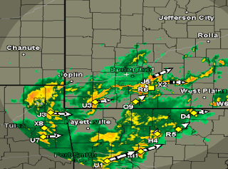
Update: May 11, 11AM -  To my untrained eye, the radar at right looks to be something of a CF - I failed to see much potential for any storm development over southern Missouri for late in the day! I could discern what looked like a developing dry line over western Texas. I was also perplexed as to the meaning of the 'pink' colored frontal system situated over on the Kansas and Missouri borders. Not sure how to read that??

11:30 AM - The temperature in the Forsyth MO area was 81°F under partly cloudy skies. The relative humidity was at 64%, and so was rather moist. Off to the southwest, radar was picking up some small cells which were moving in a northeast direction.
Looking west

12:00 Noon - I took a picture of the sky to the west - just a few lazy cumulus hanging out at the that time. The temperature had climbed a degree, then at 82F with a light southwest wind at 0-15 mph.

4:00 PM - Whatever storms that might develop tonight, will develop east of the Taney County area. Well, someone will get some rain, just not us.

Update: May 12, 4:00 AM - While it wasn't exactly a flooding rain, we did get a storm or two in the area!

Sunday, May 8, 2016

Spring 2016 has been a bit droopy..


Forsyth MO - No stat tables for this post, just a couple of observations - 1) The 'drought monkey' was still lingering around the southwest Missouri area as we have not seen much in the way of 'usual' rainfall through May 8 2016. 2) The storms that have made it to western Missouri have tended to be 'uninspired' and lacking force. As evidenced by the latest system scheduled to make its way into southwest Missouri on Monday. It looks more like an old man tying to return a full plate of soup to the kitchen! (In other words, little strength and what there is, is rather shaky).