Friday, April 12, 2013

Midland's All Hazards Weather Alert Radio!

Out of respect for the sort of severe storms my home in southwest Missouri is subject to, I decided to purchase a weather alert radio from Midland Radio Corporation over the internet. The model I selected was the WR300. It sells for about $44 at the time of this post and had some features I though might prove useful.

In addition to being a weather radio that receives the 24/7 broadcasts from the National Weather Service, the WR300 also is a radio alarm clock that can wake you with nice gentle music from the station of your choice or by a blast from a siren. Take your pick!

Yet, what I found to be really cool about this unit was the fact that it employs S.A.M.E or Specific Area Message Encoding, which enables the user to target only the county they reside in (or up to 23 adjacent counties) to receive notifications of impending severe weather. This is a great feature in that it allows one to filter out warnings when storms may not even be near where you live. I was surprised to find out that not only will it notify a person of the threats of winter storms or tornadoes, but also of over 60 other hazards including dust storms, floods, law enforcement and even biological hazards to name a few!

With it's ability to use battery backup, you can take this radio with you wherever you travel. So, it makes a great companion for anyone that travels for a living! The folks at Midland thought of everything with this product. It even supports and optional external strobe light to be used in loud environments or in homes with hearing impaired people present.

You definitely get a lot of bang for the buck with this unit and I would recommend it to anyone out there who knows that in the event of a severe weather outbreak, that seconds count!

Monday, April 8, 2013

First week of April 2013 Wx Summary

After suffering through a much colder than normal (-4°F) month of March, it was with no little relief that April arrived right on time. Interestingly, the first seven days were more in line with the trend established in March than what one would expect from it being April! The average temperature for the entire month of April is 57°F (West Plains MO data) with the Forsyth area registering 3 degrees below that level at 50.1°F. The average high temperature was 63°F and the low was 38°F when the normal for this month would be somewhere around 69°F and 41°F. So, we have some room to make up.

Precipitation likewise has been lagging behind with the historical average for the first week at .92” (4.33 for the month). We’ve had just .33 inches in that first week and so also need to catch up. (Something that could well happen in week two).

Tuesday, March 26, 2013

Check out this graph of temperatures!

Click on to enlarge
Hard to believe, but just a year ago, we we all basking in relative warmth as the high temperatures hitting the 80 degree mark on a regular basis! This March has definitely not been much of a prize with the last nine days (starting on the 17th), seeing high temperatures that were colder than the daily lows were last year!

And, it looks as though, over the coming week, this trend will be staying pretty much the same. With only a couple of exceptions (Easter Sunday the 31st and Monday April 1) we will still be hanging out in the fifties before moderating upwards to where we should be as we get into the month of April.

More local weather is available at www.taneyservices.com!

Sunday, March 24, 2013

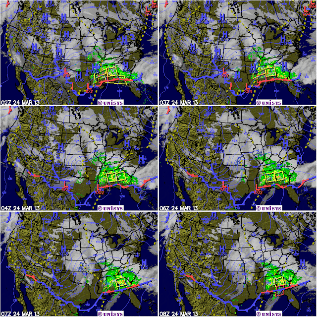
Last winter storm of the year blows on by!

What I think everyone hopes will turn out to be the last snow of the winter season, (it is spring after all), was a bit of a fizzle for us down here in southwestern Missouri and even more so if you lived near the Arkansas border.

Temperatures that held pretty steady at the forty degree mark provided just enough of a cushion to hold back what could have been another few inches of the white stuff. That would have been a second dose within a week and just days after the official start of the spring.

Now, all eyes are turned to the last week of March when a slow and gradual warm up is forecast. After temperatures that hovered below the forty degree mark for much of the prior week, a few days of sixty will feel positively bodacious!

On a more positive note, we are getting rain every few days as the atmosphere remains unstable and pulses of energy continue to move through the region. West Plains has recorded 3.23 inches of precipitation for the month while Springfield stands at 3.66 inches. Both these readings place this area ahead of normal rainfall amounts for the month to date. (My reading at Forsyth of 2.65 inches shows us to be lagging just a bit behind). And, with more rainfall forecast over the next seven days, it looks probable that we will close out the month at close to normal.

Saturday, March 23, 2013

Crawling ever so slowly to April!


Like a man who’s been lost in a cold an inhospitable desert for too long, but who now sees an oasis just ahead, he crawls slowly towards salvation.

That man is me and I’m hoping the month of April turns quickly to be the warm(er) salvation I so desperately need! Well, OK, so it’s not been all that bad a winter. But, it’s been a long one, as far as I’m concerned. March, circa 2012 was 12 degrees warmer than normal and other than the complaining of some fishermen, it was an awesome month. This March of 2013 looks destined to be some 5 to 6 degrees colder than normal and so the word ‘awesome’ has not come to my mind. Other descriptors have, but not that one.

It’s comforting to know, then, that the average temperature of April, jumps upward some 13 degrees! A figure that should kick some serious temperature bootie. And when that happens, SPRING will start to happen with all the subtlety of a freight train! Can’t happen too soon for me.

Friday, March 22, 2013

Another Winter Storm Coming? What!!


What’s wrong with this picture? The weather service out of Springfield is forecasting yet another blast of cold arctic air coming down from who knows where (probably courtesy of those mean old Canadians). That front will meet up with a glob of moisture (from the Gulf?) and will cause even more havoc in what is currently a soggy and wet southwestern Missouri. This blessed event is to come right on the heels of a snowstorm from just a day ago! ‘Heavens to Murgatroyd’, if I might quote old Snagglepus!

Yes, it appears as though parts of Missouri, especially the northern parts will get another dose of Old Man Winter on Saturday and Sunday. This storm system, which is currently hiding out in the Rockies, is due to strike the Midwest sometime on Saturday, March the 23rd. Acting more like a classic mid-winter storm than anything else, counties to the north of Forsyth will see the most action, with our area spared the worst effect. As a matter of fact, if we get lucky, all that will fall down this was will be rain! (Well, do you feel lucky punk)?

Wow! What a great snowfall!


This morning I got up and measured the snow depth by my house and came up with 4 ½ inches! There also seems to be a glaze of ice over the top so my advice to anyone this morning, would be to at least wait for the plows to come through before attempting to leave your home. While I’m not sure of the conditions in cities like Branson where they may have salted the streets and such, I can say that the rural areas will more than likely take a bit of time to clear. On a good note, this snow looks like; 1) it would make great snowman making material and 2) like it won’t be around long as temperatures should rise up to close to the 40 degree mark later today! For more, go to www.taneyservice.com!