Tuesday, March 26, 2013

Check out this graph of temperatures!

Click on to enlarge
Hard to believe, but just a year ago, we we all basking in relative warmth as the high temperatures hitting the 80 degree mark on a regular basis! This March has definitely not been much of a prize with the last nine days (starting on the 17th), seeing high temperatures that were colder than the daily lows were last year!

And, it looks as though, over the coming week, this trend will be staying pretty much the same. With only a couple of exceptions (Easter Sunday the 31st and Monday April 1) we will still be hanging out in the fifties before moderating upwards to where we should be as we get into the month of April.

More local weather is available at www.taneyservices.com!

Sunday, March 24, 2013

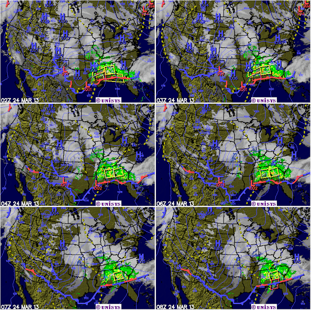
Last winter storm of the year blows on by!

What I think everyone hopes will turn out to be the last snow of the winter season, (it is spring after all), was a bit of a fizzle for us down here in southwestern Missouri and even more so if you lived near the Arkansas border.

Temperatures that held pretty steady at the forty degree mark provided just enough of a cushion to hold back what could have been another few inches of the white stuff. That would have been a second dose within a week and just days after the official start of the spring.

Now, all eyes are turned to the last week of March when a slow and gradual warm up is forecast. After temperatures that hovered below the forty degree mark for much of the prior week, a few days of sixty will feel positively bodacious!

On a more positive note, we are getting rain every few days as the atmosphere remains unstable and pulses of energy continue to move through the region. West Plains has recorded 3.23 inches of precipitation for the month while Springfield stands at 3.66 inches. Both these readings place this area ahead of normal rainfall amounts for the month to date. (My reading at Forsyth of 2.65 inches shows us to be lagging just a bit behind). And, with more rainfall forecast over the next seven days, it looks probable that we will close out the month at close to normal.

Saturday, March 23, 2013

Crawling ever so slowly to April!


Like a man who’s been lost in a cold an inhospitable desert for too long, but who now sees an oasis just ahead, he crawls slowly towards salvation.

That man is me and I’m hoping the month of April turns quickly to be the warm(er) salvation I so desperately need! Well, OK, so it’s not been all that bad a winter. But, it’s been a long one, as far as I’m concerned. March, circa 2012 was 12 degrees warmer than normal and other than the complaining of some fishermen, it was an awesome month. This March of 2013 looks destined to be some 5 to 6 degrees colder than normal and so the word ‘awesome’ has not come to my mind. Other descriptors have, but not that one.

It’s comforting to know, then, that the average temperature of April, jumps upward some 13 degrees! A figure that should kick some serious temperature bootie. And when that happens, SPRING will start to happen with all the subtlety of a freight train! Can’t happen too soon for me.

Friday, March 22, 2013

Another Winter Storm Coming? What!!


What’s wrong with this picture? The weather service out of Springfield is forecasting yet another blast of cold arctic air coming down from who knows where (probably courtesy of those mean old Canadians). That front will meet up with a glob of moisture (from the Gulf?) and will cause even more havoc in what is currently a soggy and wet southwestern Missouri. This blessed event is to come right on the heels of a snowstorm from just a day ago! ‘Heavens to Murgatroyd’, if I might quote old Snagglepus!

Yes, it appears as though parts of Missouri, especially the northern parts will get another dose of Old Man Winter on Saturday and Sunday. This storm system, which is currently hiding out in the Rockies, is due to strike the Midwest sometime on Saturday, March the 23rd. Acting more like a classic mid-winter storm than anything else, counties to the north of Forsyth will see the most action, with our area spared the worst effect. As a matter of fact, if we get lucky, all that will fall down this was will be rain! (Well, do you feel lucky punk)?

Wow! What a great snowfall!


This morning I got up and measured the snow depth by my house and came up with 4 ½ inches! There also seems to be a glaze of ice over the top so my advice to anyone this morning, would be to at least wait for the plows to come through before attempting to leave your home. While I’m not sure of the conditions in cities like Branson where they may have salted the streets and such, I can say that the rural areas will more than likely take a bit of time to clear. On a good note, this snow looks like; 1) it would make great snowman making material and 2) like it won’t be around long as temperatures should rise up to close to the 40 degree mark later today! For more, go to www.taneyservice.com!

Tuesday, March 19, 2013

Snow to our north and rain in Forsyth?


When the National Weather Service uses the term ‘the devil is in the details, that’s their code way of saying, ‘we ain’t got a clue’; and that is the case with a very complex system that will affect parts of southwestern Missouri over the next 48 hours or so. In a nutshell, Missouri will be center stage for the coming together of cold air and warm Gulf moisture. A situation that would normally imply frozen precipitation of some sort were it just a bit earlier in the year. But, seeing as it is the later part of March, thermal profiles will play an increasingly important role as to what actually ends up falling from the skies.

That said, I have a feeling, call it a gut feeling that the inclement winter weather will sag just a bit further to the south than what the weather service is currently indicating. I’ve reflected that in the graphic above and yes, much will depend what can be termed as a ‘warm nose’ of air that may well push its way across the area in the middle of the evolving events. Should that happen, it would be an all rain event with little if any snow.  

Saturday, March 16, 2013

March Weather Madness!

Of all the months of the year, March holds the distinction for being the most changeable when it comes to hot and cold changes! After two back to back warm (even hot) days, the winter weather switch is about to be flipped as a colder frontal system comes barging into backyards where us men are desperately trying to get their early weekend barbeque started.

With the much colder air will come the real possibility of copious amounts of (much needed) rain. As much as an inch and a quarter is being forecast by the National Weather Service for some spots around the Forsyth area overnight tonight and into Sunday.

But wait! There’s more. As the coming week wears on, it will be the 50’s as usual with another blast of even colder air arriving around midweek. And yes, boys and girls, snow may even be in the forecast for the Thursday to Friday time frame.

Well, it is March and warmer days are just ahead! We hope!

Thursday, March 14, 2013

Countdown to Spring!

Note that the above graph shows average temperatures!
With just seven more days to go before the official arrival of spring on March the 20th, I've got some good weather news. Temperatures, which had been averaging 6 degrees below normal are forecast to do a 180 and jump up to 6 degrees above normal. Be still my yammering heart! In the graph above the blue line represents the next 8 day average of about 51F while the dashed line is the normal average for this time of year.

The only fly in the ointment will be the rapidly increasing juniper, oak and maple tree pollen levels. The bane of allergy suffers like myself! This picture a juniper at right illustrates the point. They all look brown, not because of dead limbs, but due to massive loads of pollen that they are getting ready to unleash upon the world! (These high pollen levels will be pretty much be the rule for the next few weeks with only occasional rains to help knock them down).

So, for the most part, it's a win-win situation as it warms up out there and all those neat signs of spring begin to happen. Before we know it all the trees will be leafed out and the area will lose that brown drab look it's sported all winter long. That will signal to me that it's time to sit outside in my back yard and light up the barbeque!

Monday, March 11, 2013

March 2013 on track for mid-month warm up!

Down where I live in southwest Missouri, the temperature trends are right in line with historical averages. While we started the month on a very cold note, things have quickly gotten back in line with a first week average temperature of 38°F. The second week (of which we're halfway through) is currently running at 49°F. and the projected average for the third week looks to be about 55°F. That's encouraging! As soon as the mean temperatures gets up to and past the fifty degree mark, the ground outside warms to the point where new plant growth begins to accelerate. Not surprisingly, protected south facing spots even have a few daffodils now in bloom!

The only potential fly in the spring ointment, will be any possible effects of global warming which may have been responsible for some strange weather in the past. A case in point was last March, which was twelve degrees above the historical average! Talk about a warm start to spring! We then went right from there onward to a very dry and hot summer. As a result, many cool loving vegetables like onions and potatoes really suffered. This year, at least so far, we are right in the sweet spot of what is considered normal. (And yes, even our rainfall has been adequate)! I'm hoping these trends continue.

Friday, March 8, 2013

Warming trend for March continues!


The warming trend for southwestern Missouri will continue on into the second week of the month as mean temperature reading in the fifties begin to show up more and more often. Anytime the fifty degree barrier for an average is broken, you can expect relatively nice days in the mid to upper sixties on most days! This kind of weather is good for everyone as it allows us to all get outdoors and exercise a little bit more than we might in colder times. Note that we are still way off the pace set in 2012 when that month averaged 12 degrees above normal!

Sunday, March 3, 2013

By golly, I think it's going to get warmer! And yes, it will!

A13 number in blue = forecast means or averages.
After suffering through a week, lo these past seven days under overcast skies and much colder than normal temperatures, we may be getting a break. Believe it or not, there are some sixty plus degree day starting tomorrow on Monday, March the 4th! (Be still my heart)! And, the trend only seems to get better as we 'march' through the next seven days!

For sure, when you compare the temperature variances with last year, it really sucks, but last year was a barn burner month that averaged an unheard of 12 degrees above average! So, if this coming week is at or a little bit above average, then we should still be thankful. Yes? No?

the only thing missing, at this point in time, is the lack of a good soaking rain. However, it's early in the month and that may change quickly!

Friday, March 1, 2013

February 2013 Wx Summary


Click on to enlarge

Believe it or not, this past February in Taney County MO was somewhat warmer than average. Hard to reconcile that when the last week of that month was so cold! Truth is that the month ended with an average of 38.2°F versus a historical average of 37.9°F (West Plains data). More surprising, (or not for all you global warming theorists) was the average lows which came in 5 degrees warmer than the 30 year average. Wow!

On another and happier note, rainfall totaled 3.14 inches at my location in Forsyth Missouri (DanO’s Place) and so exceeded the published West Plains average of 2.84 inches for the month. That will be good news for local farmers as we seem to be holding our own for at least the first couple of months of the year.